How to Extract Landslide Slope and Grid Unit Using QGIS only
LaGriSU: QGIS Tools of Grid Units and Geo-Morphological Slope Units Extraction for Landslides events Inventory
4.42 (31 reviews)
223
students
7 hours
content
Mar 2023
last update
$49.99
regular price
What you will learn
Automatically Generate training and testing data using Grid or Slope units for entire study area with DEM (Digital elevation model ) only
Easily able to create your own modeler tool in QGIS environment
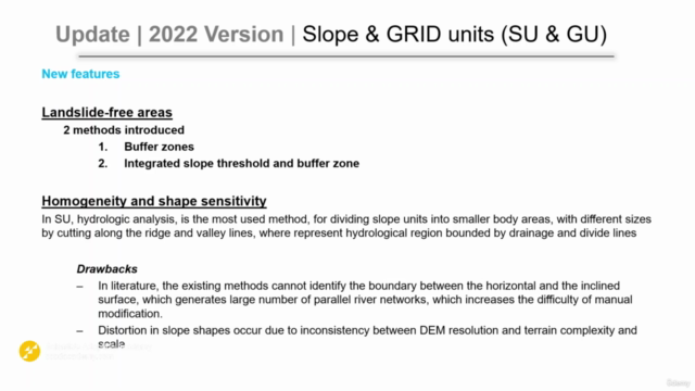
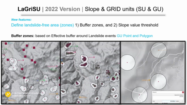
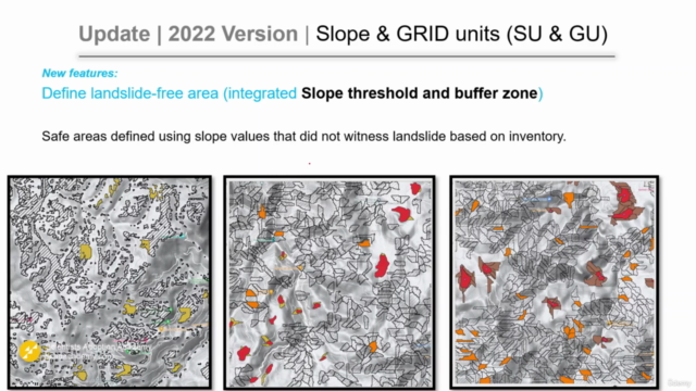
Automatically generate free-landslide areas for Grid units and slope units
Automatically generate training data using Grid unit and slope units
Understand and apply the different mapping units in susceptibility mapping
Learn how to easily choose the wright and appropriate pixel dimension for your map
Hydrological analysis to produce slope units out of streams network intersections
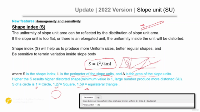
Screenshots
Related Topics
1839274
udemy ID
8/5/2018
course created date
3/22/2020
course indexed date
Bot
course submited by